Environmental Impact Report Images
Requested EIR images from indicated station points.
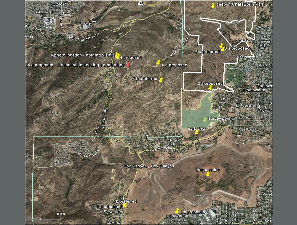
Please note: '4 a' is inaccessible on a private
road with uncooperative owners...
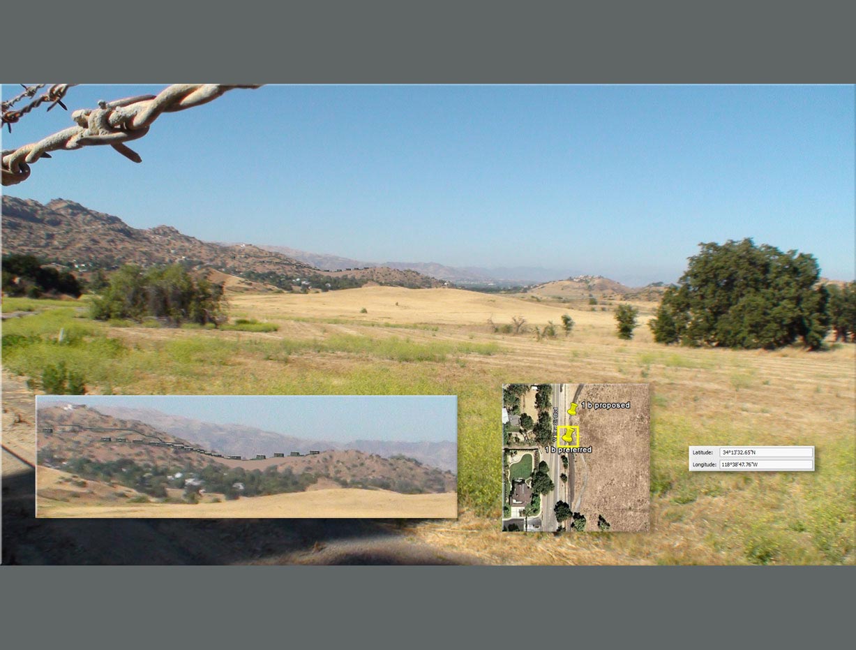
The site is visible at approximately 1.5 miles.
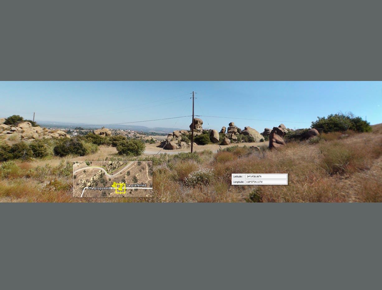
The site is not visible from bordering state park land.
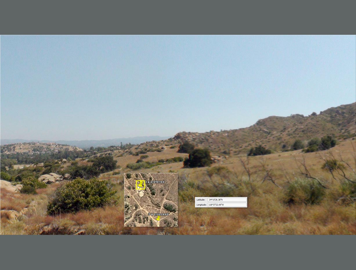
The site is not visible from state park land at approximately
1 mile.
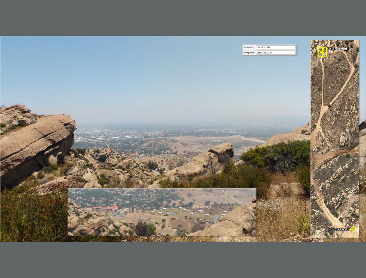
The site is not visible from point "4B proposed"
at 1 mile. It is visible, at just under .8 mile, from nearly inaccessible
private land at point "4B preferred".
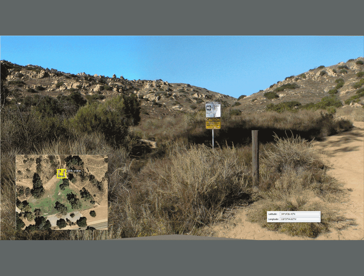
Additional view; the site from the local park on Valley Circle
showing location of fill, with proxy massing models of structures.